
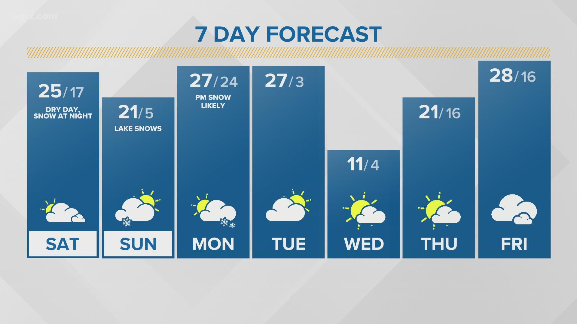
BUFFALO, N.Y. — Storm Team 2 is closely monitoring the movement of an arctic high-pressure system that will bring cold temperatures through Saturday morning. This will be accompanied by a surge of arctic air, bringing bitterly cold temperatures and wind chills.
In fact, temperatures did drop below zero degrees Friday morning across portions of Western New York and will again Saturday morning, which would be the first time that's happened since February 1, 2019 when it was -4 degrees that morning. For those keeping track, that's 1,084 days.
Winds have been relatively calm too since this cold blast moved in Thursday night, but that will change by Saturday morning. It won't be too breezy, but any wind will make a difference. Wind chill values will quickly fall below zero Friday night and land between -10 to -15 degrees Saturday morning.
This bitter of cold temperatures could warrant cold weather alerts too. Best think ahead to any plans for this cold timeframe and how they can be adjusted for the cold.
And another cool weather phenomenon accompanied this arctic blast: light pillars! These occur when ice crystals bend and reflect light from a source, like a street lamp, because even this cold of conditions change the orientation of ice crystals in the sky. You can read more about light pillars here.